iMykonosA visual guide of Mykonos, a famous island of the Cyclades, featuring embedded maps, useful information, photos, and points of interest including beaches, utilities, and the archaeological site of Delos.
Un guide visuel de Mykonos, une des plus célèbres îles des Cyclades, comprenant des informations pratiques, des photos, des cartes utilisables hors connexion et des informations sur le site archéologique de Délos.
iMykonos
A pictorial guide of one of the most famous Cyclades islands, in the Aegean Sea, featuring embedded maps, useful information, photos, and points of interest including beaches.
It has been created by fusions.ch, a non-profit organization maintaining and developing websites dedicated to culture and tourism in Switzerland and Greece.
To use this guide, you don't need to be connected, except to get a route. It is fully iPhone and iPad compatible (to get the best of the photos you should use it with an iPad).
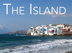
It features an embedded map and photos of Chora (Mykonos Village), one of the most beautiful villages of the Cyclades, a relief map of the island with POIs (including the most beautiful beaches), and informations about the sacred island of Delos.
This new version is enhanced with more informations and lots of scenic photos and panoramas!
This guide is part of the iCyclades Free iOS Apps Collection produced by fusions.ch, a series of free guides made by travelers for travelers.
To plan your trip to Mykonos and get the best of your stay, we recommend to get the iCyclades app too (general info, climate, travel, gastronomy, oenology, and more) and the GreekMaps app (relief maps of all islands).
And if you wish to visit more Cyclades islands, get the iParos, iAntiparos, iNaxos, iSyros, iAndros, iTinos, iSantorini, iSifnos, iMilos, and iAmorgos apps too!
CONTACT ADDRESS- No info available, sorry.
(You may find a contact on the website mentioned below.)
USEFUL LINKSOUR PANORAMIC GUIDE
This guide features more places in the same region, check them out!
©
fusions.ch 1988-2025
All rights reserved for all countries