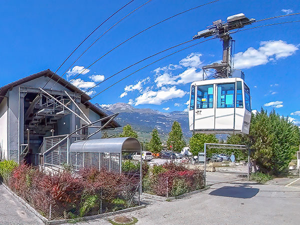
ChalaisChalais lies at an altitude of 522 m at the foot of the southern slopes of the Rhône Valley, just a few kilometres from Sierre. It is the departure point for the cable car that climbs to the famous village of Vercorin.
Chalais
Chalais lies at an altitude of 522 m at the foot of the southern slopes of the Rhône Valley, just a few kilometres from Sierre. It is the departure point for the cable car that climbs to the famous village of Vercorin.
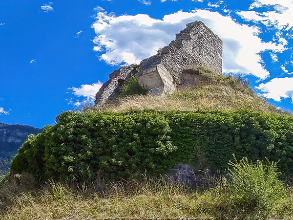
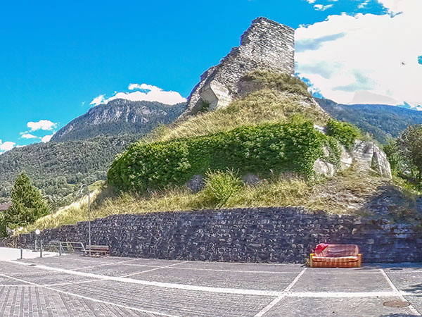
Once part of the seigneury of Sierre, Chalais became a castellany in the 13th century under the vassals of the bishop of Sion, who lived in the old square tower whose meagre ruins stand on a hillock at the entrance to the village.
Chalais and Vercorin have been administratively united since the 16th century. In fact, it was probably the inhabitants of Vercorin, who were going down to the plain to cultivate their vines, who founded the village of Chalais, for reasons of convenience.
Again for the sake of convenience, in the 19th century the inhabitants of Chalais had a bridge built linking their village to the hamlet of Noës on the opposite bank of the Rhône.
In the past, to get to the land they farmed on the right bank of the Rhône, they had to cross the river at two relatively distant bridges, one near the village of Granges, the other at the western entrance to the Finges Woods.
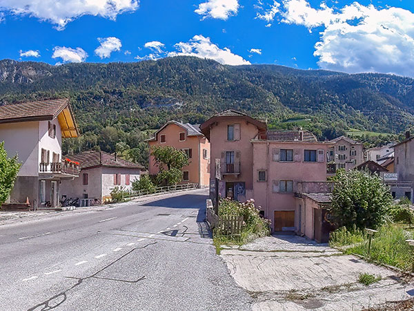
Today, the villages of Chalais, Réchy and Vercorin, as well as the hamlet of Briey, form a single municipality with a population of around 3,200... although Vercorin welcomes over 4,500 visitors at the peak of the tourist season.
CONTACT ADDRESS- Office du Tourisme de Vercorin
Route d'Anniviers 1
CH-3967 Vercorin
USEFUL LINKSSWISS CANTONOUR PANORAMIC GUIDE
This guide features more places in the same region, check them out!
©
fusions.ch 1988-2026
All rights reserved for all countries